About Louisiana - Marine Charts boat
THE ALL NEW ADVANCED MARINE RASTER NAUTICAL CHARTS APP FOR BOATERS AND SAILORS! THIS MAP PROVIDES ALL THE NECESSARY TOOLS FOR EASY NAVIGATION ON WATER. CONTINUOUS CHARTS DISPLAY MAKES IT MORE EASIER FOR SAILING AND AS...
THE ALL NEW ADVANCED MARINE RASTER NAUTICAL CHARTS APP FOR BOATERS AND SAILORS!
THIS MAP PROVIDES ALL THE NECESSARY TOOLS FOR EASY NAVIGATION ON WATER. CONTINUOUS CHARTS DISPLAY MAKES IT MORE EASIER FOR SAILING AND AS THERE WILL BE NO INTERNET ON SEA, THIS CHART IS FASTER FOR NAVIGATION.
NO WAITING TIME FOR NAUTICAL CHART DOWNLOADS. READY TO USE, SEAMLESS FOR CONTINUOUS NAVIGATION!
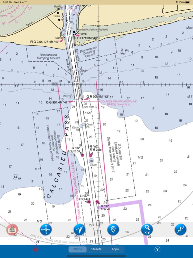
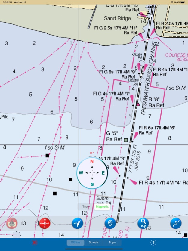
COMBINATION OF COASTAL CHARTS, SMALL CRAFT AND HARBOR CHARTS FOR EASY NAVIGATION.
ALL CHARTS OVERLAY IS ARRANGED IN A SEAMLESS ORDER, BASED ON CHART SCALE AND PRIORITY.
NO NEED TO CHANGE CHARTS MANUALLY, THEY ARE READY FOR CONTINUOUS NAVIGATION.
● ALL MARINE RASTER NAUTICAL CHARTS ARE FROM NOAA SOURCES.
● ALL CHARTS ALIGNED WITH ORIGINAL CHART CO-ORDINATES, ARE ACCURATE FOR USE.
● GPS - SHOWS & UPDATES USER CURRENT LOCATION ON MAP.
● SEAMLESS CHART OVERLAY DISPLAY, USE THEM AS LONG AS YOU BOAT.
● HIDE AND SHOW CHART OVERLAY TO SEE DIFFERENCE IN AERIAL OR OTHER MAPS.
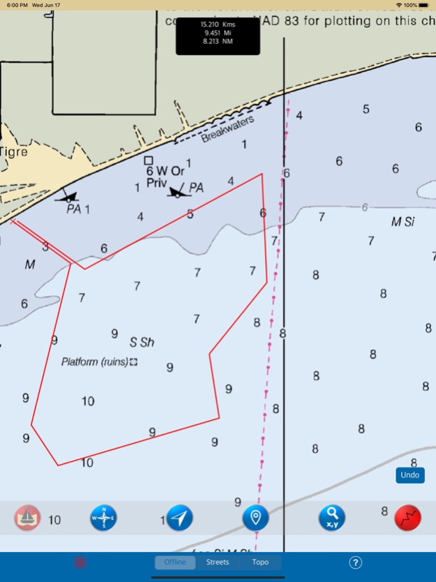
● INTERACTIVE COMPASS, MOVE AND PLACE ANYWHERE ON MAP SCREEN.
● KNOW ANY LOCATION COORDINATE WITH A SINGLE TAP.
● FIND DISTANCES WITH ROUTE TOOL, DRAW ON MAP AND NAVIGATE ALONG THE ROUTE.
● GOTO MAP LOCATION BY ENTERING LATITUDE/LONGITUDE.
● INSERT UNLIMITED FAVOURITE MARKERS ON MAP. PHOTO TAGGED FACILITY FOR MARKERS WITH EMAIL OPTION. ADD MULTIPLE PHOTOS TO FAVOURITE MARKERS (MAX 3 ALLOWED). EMAIL FAVOURITE MARKERS AS KMZ FILE.
● MAP USER INFORMATION.
NOTE: All charts are Geo-positioned to match the exact location of features displayed on charts but there may be some difference between the positions of actual objects that are in the water or sea and charts because of the different chart scales.
Disclaimer: The Raster Nautical Charts data provided in all charts is from NOAA and is for reference purposes only and not for navigation.
We strive to provide the best products to the customers. Any suggestions from the users of this product are welcome to make the app more useful.
HAPPY BOATING AND SAILING ALL THE TIME!
Jun 17, 2020
Version 3.5
- Important bug fixed when map not showing in lower zoom levels in iOS13.
- Supports new devices.
- Compatible to iOS 13.
Previous Versions
Here you can find the changelog of Louisiana - Marine Charts boat since it was posted on our website on 2021-12-07 19:29:01.
The latest version is 3.5 and it was updated on 2024-04-22 17:51:55. See below the changes in each version.
Louisiana - Marine Charts boat version 3.5
Updated At: 2020-06-17
Changes: Jun 17, 2020 Version 3.5
- Important bug fixed when map not showing in lower zoom levels in iOS13.
- Supports new devices.
- Compatible to iOS 13.
Disclaimer
Official App Store Link
We do not host Louisiana - Marine Charts boat on our servers. We did not scan it for viruses, adware, spyware or other type of malware. This app is hosted by Apple and passed their terms and conditions to be listed there. We recommend caution when installing it.
The App Store link for Louisiana - Marine Charts boat is provided to you by apps112.com without any warranties, representations or guarantees of any kind, so access it at your own risk.
If you have questions regarding this particular app contact the publisher directly. For questions about the functionalities of apps112.com contact us.